Land Management
Forested Natural Areas

Project: Riparian crack willow: benefit, harm, or both for stream fauna?
Partner: UMD
Timeline: Through 2027
Description: Using grant funding from LCCMR, UMD, the City and other partners will be investigating the role of white crack willow on our streams. White crack willow is invasive and spreads easily. It is found along many of our local streams. Despite the beneficial shade it provides to coldwater trout streams, the willow's blood red roots smother stream beds, interrupting flow and burying trout habitat. UMD and the City will identify several sites where willows are present and study their impact on stream morphology and aquatic species.
Project: Tree planting and continued stewardship
Partner: The Nature Conservancy
Timeline: 2024, 2025
Description: The Nature Conservancy has been generously planting seedlings on City land for several years. These trees are seedlings, are protected with cages or cones, and TNC revisits them every year to check on their progress. Yellow birch, red oak, and white pine have been planted along lower Mission Creek, north of Lester Park, in Quarry Park, and near Downer Park. Sites are determined every spring depending on TNC crew availability and City planting priorities.
Project: Under-Ash Planting in St. Louis River Coastal Wetlands
Partner: Minnesota Land Trust
Timeline: Continuing, beginning in 2019
Description: The Minnesota Land Trust is planting native tree species in Ash stands along the St. Louis River. This work is part of the City's continued management of our Designated Natural Areas. All Ash within the City will eventually die due to Emerald Ash Borer, as once this pest infests an area, Ash mortality is nearly 100%. Critical floodplain forest habitat and other ecosystem services will be lost with the demise of Ash, so many organizations are working hard to underplant in Ash stands while the trees are still living. If nothing is intentionally planted within these stands, invasive species such as buckthorn will likely move in and the ecosystem will change from a floodplain forest to scrubby wetland with little habitat value.
Project: Knowlton Creek Northern White Cedar/Eastern White Pine Forest Management Project.
Partner: W. J. McCabe Chapter Izaak Walton League
Timeline: Continuing, beginning in 2022
Description: In 2022, the local chapter of the Izaak Walton League adopted a forest restoration site along Knowlton Creek to protect water quality and a unique white pine-white cedar forest community. The chapter protects seedlings with fencing or other methods, removes invasive species, and generally tends to the area whenever their members have time.
Project: Tree Seedlings and Planting
Partner: The Rajala Woods Foundation
Timeline: The Foundation plants trees about every year on City lands.
Description: Rajala Woods is devoted to restoring native forests, conserving natural ecosystems and ensuring public access for recreational use and enjoyment. The Foundation grows their own white pine seedlings and generously plants them, with browse protection, for the City at no cost. In the past couple of years, they have been focusing in the Upper Amity Creek/Seven Bridges Road area.
Project: City-Wide Mapping of Native Plant Communities
Partner: Minnesota Land Trust
Timeline: Mapping completed, final deliverables expected spring 2026
Description: What plants and trees are supposed to be in our City forests? Are they present? Are non-native species such as Scotch Pine taking up space that native red or white pine should be inhabiting? Or are invasive species, such as buckthorn, completely taking over the forests, such as in many parts of Hartley? These are questions that can be answered with Native Plant Community (NPC) mapping. NPC mapping is a bit like doing a color by number project you did as a child. Throughout the City, there are different natural communities - white pine forests in Lester Park; black ash wetlands of Mission Creek; or meadows at Hartley - that each take up a certain amount of space. Professionals familiar with northern Minnesota NPCs can look at the elevation of an area, the soil types, and past records of what was found where, and determine what sort of plant community is present, or is supposed to be there. For example, a community commonly found in our area is Northern Wet-Mesic Boreal Hardwood-Conifer forest. Thanks to the solid partnership that the City and Minnesota Land Trust have developed over many years, 10,000 acres of the City's lands were mapped in 2025. Once the final deliverables are complete, the City will have the information necessary to be more strategic in our land management efforts and seek funding to improve our natural resources. A presentation on this project was presented to the Natural Resources Commission on June 7, 2025, and can be found here. Funding for this project was provided by the Minnesota Environmental and Natural Resources Trust Fund as recommended by the Legislative-Citizen Commission on Minnesota Resources (LCCMR).
Project: Development of Forestry Prescriptions for Mission, Piedmont, and Amity-Lester Forests
Partner: Minnesota Land Trust
Timeline: Prescriptions are expected by summer 2026; the City hopes to apply for grant funding to implement the prescriptions in Fall of 2026.
Description: A forest prescription (or silvicultural prescription) is a site-specific, written document created by a forester that details planned treatments to achieve specific management goals, such as habitat improvement, planting, or invasive species management. It acts as a management plan to transition a forest stand from its current condition to a desired future site, often spanning many years.
City of Duluth Prescribed Fire Program
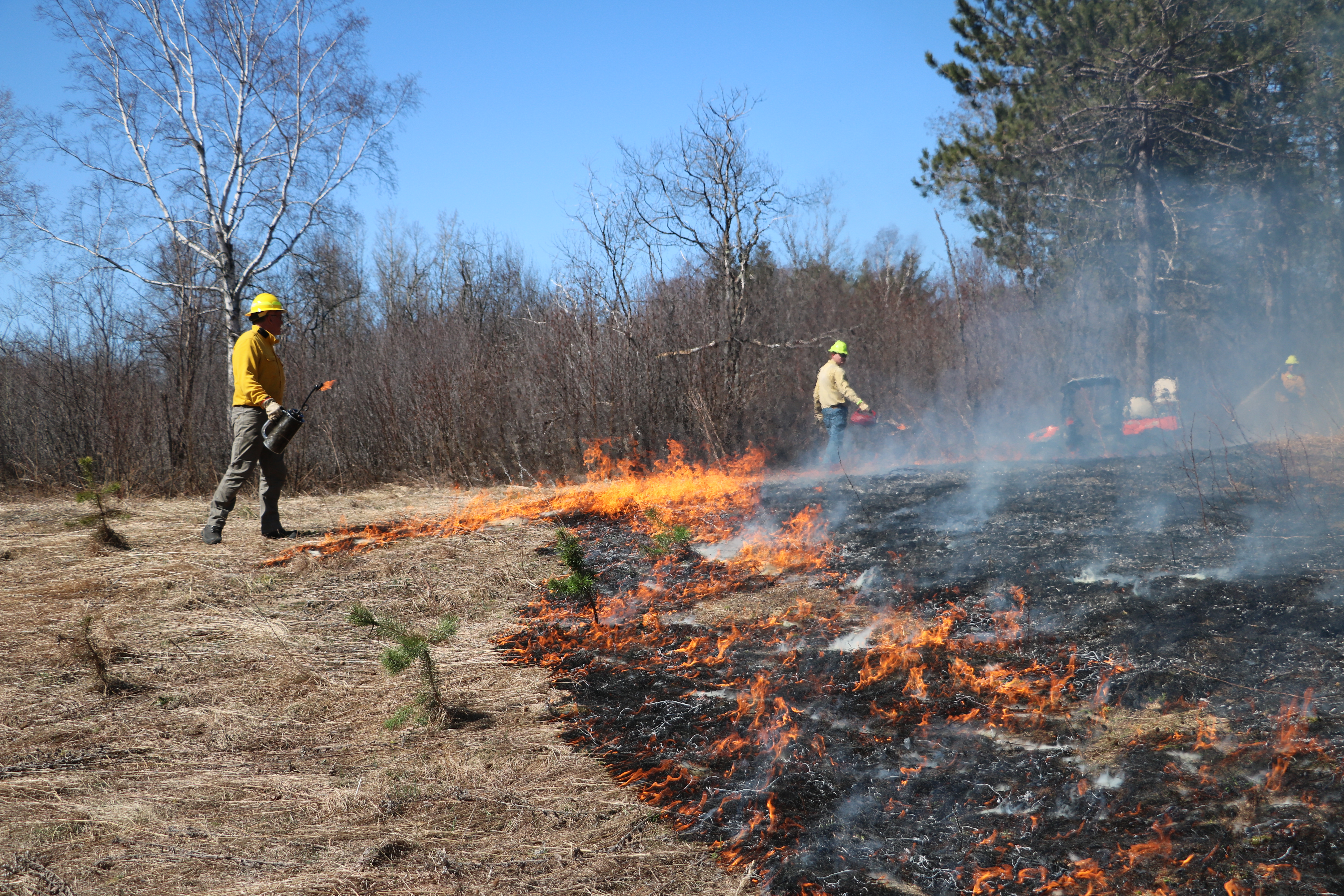
Controlled burning, also known as prescribed burns or prescribed fire, is a land management strategy that uses the application of fire to support healthy ecosystems. Controlled burns provide significant benefits to the landscape and have been used as an intentional land management technique for thousands of years. Prescribed burns are also culturally important to our Tribal communities.
The Duluth Fire Department, in coordination with other City departments, is working to establish a City Prescribed Fire Program. Planning for the program began in 2023, when City staff identified opportunities to collaborate across departments to support shared land management and public safety goals.
The City manages thousands of acres of forested land that require ongoing stewardship. Prescribed fire is a proven land management tool that can help the City improve forest health while also providing training opportunities for firefighters. More information on this program is provided below.
Prescribed fire is the planned and controlled use of fire to manage natural landscapes. When conducted under carefully monitored conditions, it can help the City achieve several land management goals, including:
- Reducing invasive plant species
- Lowering hazardous fuel loads that can contribute to wildfires
- Promoting the regeneration of native vegetation
- Supporting healthier and more resilient forest ecosystems
Like many municipalities, the City of Duluth has limited staff and funding available for land management. Prescribed fire allows staff to address multiple management objectives efficiently and effectively.
The Prescribed Fire Program also supports training for Duluth Fire Department personnel. Conducting controlled burns provides firefighters with hands-on experience in wildland firefighting techniques.
This training helps ensure personnel are prepared to respond to wildfires within the Duluth area and, when requested, assist other communities. The program represents a collaborative effort between City departments to advance both land management and public safety goals.
Prescribed burns are carefully planned and conducted only under specific weather and site conditions. Prior to any burn, trained personnel evaluate factors such as:
- Weather conditions
- Wind speed and direction
- Moisture levels in vegetation and soil
- Smoke management considerations
Burns are conducted by trained staff following established safety protocols, and fire crews remain on-site throughout the operation to monitor conditions and ensure the fire remains within the planned burn area.
Residents near a planned burn area may notice:
- Smoke in the area during the burn
- Fire department personnel and vehicles on site
- Temporary trail or park closures in the burn area
Burns are typically completed in a single day, although crews may remain on-site afterward to monitor the area and ensure the fire is fully extinguished.
The City's properties/natural resources division and the Duluth Fire Department are currently planning four prescribed burns for 2026:
- Chambers Grove - the management goal here is to knock back some willows that have become too dense and numerous.
- Piedmont Park - the pollinator gardens will be burned as is recommended every 3-5 years.
- Hartley Designated Natural Area "The Pines" - red pine regeneration and knocking back invasive buckthorn is the goal here. This burn is slated for the fall.
- Hartley Designated Natural Area "Oak Woodland Unit" - the oaks here are fire dependent and need regular fires to function at their best. This area is located in the SE part of the Natural Area.
Burns can only occur when specific weather conditions are met, so the exact day of the burns is difficult to predict. The Duluth Fire Department will be managing the burns, and they will decide the morning of whether conditions are right. On the days burns are conducted, information will be shared in the following ways:
- On this webpage
- Through City press releases
- On official City social media channels
- Via Hartley Nature Center for the Hartley burn sites
A prescribed burn is also planned on Minnesota Point for 2026. This burn is being coordinated by the Park Point Community Club and the Minnesota DNR. More information on this burn can be found on the Park Point Community Club's website.
Pollinator Meadows
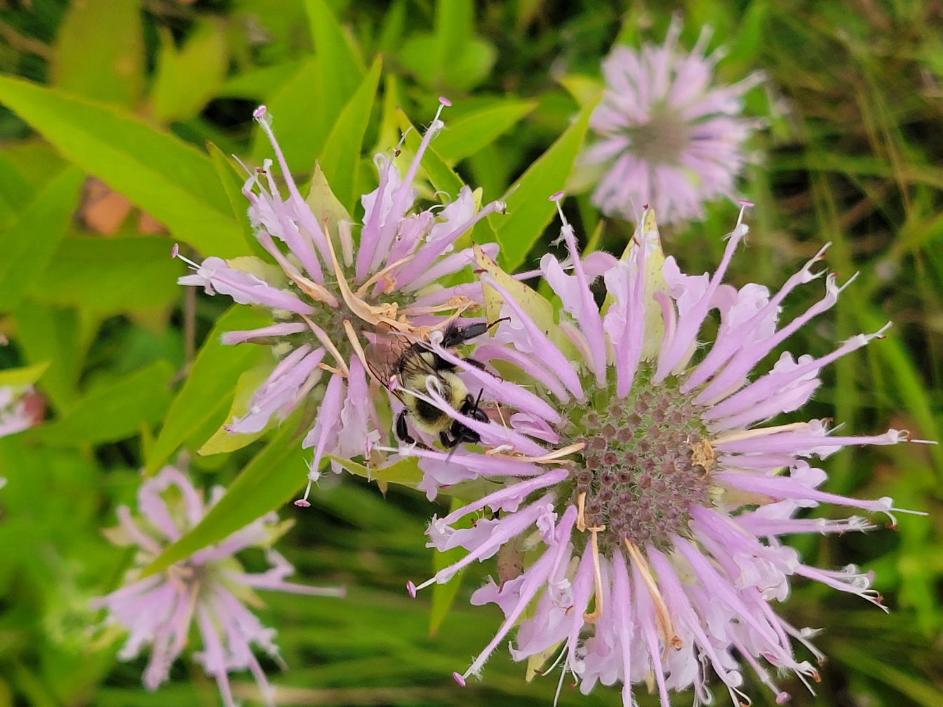
The City has restored several small areas to pollinator meadows including along the Marten Trail, in Piedmont Park and in Hartley Park. Urban development and pesticide use are causing great stress to pollinator species, so anything we can do to provide habitat in open areas for them will support our larger ecosystem. Once a pollinator garden is planted, continued stewardship including spot spraying or hand pulling weeds/non-natives is necessary for the first few years. The City's Natural Resources Management Program hires contractors to perform this work as funding allows.
Strategic Public Lands Re-alignment Project
In 2023, the City acquired over 2,000 acres (approx. 700 parcels) of tax-forfeit lands from St. Louis County. This multi-year project was funded in part by a Great Lakes Restoration Initiative grant fund from the EPA. Many of these newly-acquired parcels are already being used for public enjoyment and recreation, such as many tracts in the Lester Park and Piedmont areas. However, as tax forfeit property, these parcels could have been sold at any time. Under City ownership, this acreage will be preserved for recreation, as parks or enlarged parks, and as designated Natural Areas. Many City and County staff have been involved in this project including City Planning, Stormwater, Properties, and Parks & Recreation staff. St. Louis County has also been a dedicated partner in the process.
For more information, visit Chapter 2 of the Natural Resources Management Program Plan.
Invasive Species Management
The City is on a seemingly never-ending battle with invasive species, and depending on funding and capacity, we do our best to tackle the myriad invasives that threaten our natural areas. Buckthorn, Honeysuckle, Knotweed, Garlic Mustard and Wild Parsnip are the species of most concern to the City. Our Parks Maintenance division is able to lend out tools, including buckthorn pullers, gloves, and garbage bags, to help individuals or groups voluntarily remove invasives - please call (218) 730-4490 if you are interested in getting assistance to help remove invasive species from our public lands.