Guiding Documents

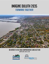
 The Comprehensive Land Use Plan, Imagine Duluth 2035, was adopted in 2018. An update to the 2006 Comprehensive Land Use Plan, it is a policy document that describes the 20-year vision for the city. It is also the foundation upon which Duluth’s regulatory tools (zoning, subdivision, shoreland, floodplain, and other ordinances), and capital improvement program rest.
- Imagine Duluth 2035
- Executive Summary
- Background
- Community Engagement
- Governing Principles
- Economic Development
- Energy & Conservation
- Housing
- Open Space
- Transportation
- Land Use
- General Development
- Transformative Opportunities
- Metrics & Measurements
- Appendices
- Community Survey Results
- Health in All Policies Survey results
- Youth Engagement Results
- Irving Fairmount Brownfields
- Imagine Canal Park Summary
The Consolidated Plan is a five year planning document. It lays out the goals for the City of Duluth’s Community Development program. Based on a collaborative process involving community members and local organizations, the City establishes a unified vision for effective, coordinated neighborhood and community development strategies. The current Consolidated Plan outlines the community’s goals and objectives for 2025 through 2029. Click here to learn more and to view the Consolidated Plan.